Mountains by Starlight: Sketching the Land, Reading the Sky
Today we explore how pairing hand-drawn topographic maps with real-time digital sky charts can transform mountain navigation, especially when daylight fades or terrain becomes deceptive. Pencil lines capture slopes, ridges, and the feel of ground underfoot, while live star maps deliver precise azimuths, time cues, and celestial cross-checks. Together they create resilient clarity: analog awareness reinforced by dynamic, astronomical reference. Bring your compass, curiosity, and red headlamp. Ask questions, share your route sketches, and tell us which constellations guide your steps. Let’s learn a craft that honors precision, creativity, and the wild night.
Why Paper Lines Meet Celestial Grids
Durability You Can Hold
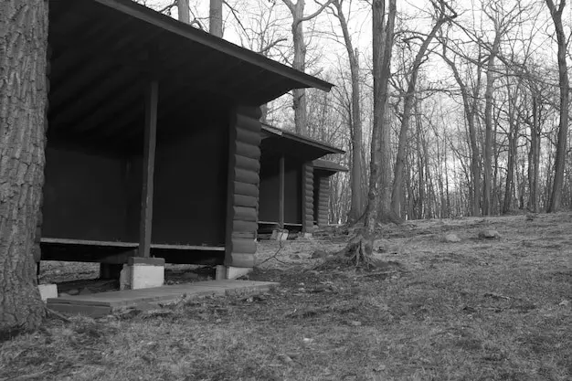
A handmade map resists cold, glare, and sudden software quirks. Its margins hold pace notes, wind arrows, cairn sketches, and hazard symbols tailored to your day. You remember what you draw; every contour becomes felt knowledge. Moisture-resistant paper and a simple pencil outlast long nights. When digital screens fog or fingers numb, the page remains readable. Your drawing evolves alongside the route, turning from preparation into living record, empowering clearer choices when exposure, fatigue, and uncertainty try to rush judgment.
The Sky as a Moving Compass
A real-time sky chart translates celestial mechanics into practical guidance. Align north, calibrate tilt, and let Polaris anchor direction while Orion’s belt suggests helpful east–west cues. Even with partial cloud, bright stars and planets provide steady reference lines. The app’s alt-az grid becomes a floating protractor, revealing azimuths that complement your compass. When valleys distort wind and echo, stars remain honest storytellers. You gain a second, independent framework for orientation, cross-checking silhouettes and summit profiles noted on your hand-drawn sheet.
A Workflow That Respects Both Worlds
Begin by sketching a clean base with key contours, watercourses, and handrails, then prepare your sky app with offline packages, dark mode, and calibrated sensors. On the move, verify ridge directions by comparing drawn spurs against star-derived azimuths. Log anomalies, redraw slopes after fresh snowfall, and tag times when constellations cross meridian. Back at camp, refine notes, mark safe retreats, and export lessons learned. This rhythm cultivates craft, balancing analog intuition and digital precision without surrendering judgment to either tool.
Field Craft: Drawing Your Own Contours
Creating your own topographic sketch trains your eye to notice gradients, gullies, and subtle aspect changes that printed maps often generalize. Start with reference bearings, then let pacing and slope angle readings shape the lines. When you commit terrain to paper, memory strengthens route choices and hazard recognition. Emphasize clarity over artistry: confident lines, consistent intervals, and readable labels save time in weather. Each stroke becomes an anchor in a storm, an argument against drift, and a promise to travel deliberately.
Start with Structure, Not Detail
Block in the broad skeleton first: ridge crests, valley axes, major drainages, and obvious cols. Add a magnetic and true north reference plus scale ticks based on measured paces and altimeter checks. Only then invite contour sweeps that mirror actual slope behavior. Keep index contours bolder for quick interpretation at night. Leave intentional white space for notes. By resisting premature detail, your map stays adaptable, legible, and genuinely responsive when the landscape contradicts early assumptions.
Measure Slope Like a Craftsperson
Use a simple clinometer, trekking pole inclinometer stickers, or even a phone’s level (airplane mode), then translate readings into contour spacing that communicates risk and flow. Pair slope data with underfoot texture: scree, neve, krummholz, or turf. Annotate cornice suspect edges with dashed shading. Mark sun crust on aspects likely to refreeze after dusk. These micro-observations enrich the drawing, giving you a tactile map that anticipates footing challenges in the dark while speeding safer micro-route choices.
Encode Landforms for Night Reading
Choose symbol conventions you can interpret under a red lamp: triangles for cairns, hollow circles for springs, hatched avalanche paths, and thickened ridgelines for handrails. Label features from multiple approach angles, not just one viewpoint. Add time-stamped notes for shadow behavior near dusk and dawn. Contrast lines purposefully so important edges pop without glare. When you look up to confirm azimuths by stars, the page must translate instantly, preventing hesitation in wind, cold, or shared rope situations.
Real-Time Sky Charts Done Right
A sky app is only as trustworthy as its calibration and configuration. Before leaving, preload offline star catalogs, set red mode, reduce brightness, and disable notifications. In the field, calibrate away from metal, re-check compass offsets, and lock orientation to prevent drift. Learn core constellations so you are never screen-dependent. In marginal weather, focus on bright asterisms and planetary beacons. Treat the device as a precise, limited resource: confirm bearings, capture time-synced notes, then pocket it to preserve batteries and night vision.
Integrating Bearings: From Declination to Star Azimuth
The aim is convergence: magnetic, true, and celestial references singing the same note. Correct your compass for local declination, orient the hand-drawn map to true north, and let a known star’s azimuth validate the alignment. When terrain funnels perspective, celestial bearings add authority. Sketch bearing lines on paper, note times beside them, and compare with ridge directions underfoot. This triangulation exposes small errors before they become big detours, delivering navigational harmony you can feel in your stride.
Weather Windows and Honest Checkpoints
Set pre-agreed decision points based on wind thresholds, freezing levels, and cloud ceilings, then honor them. If stars vanish behind building haze, expect rime and slick slabs. Track barometric trends alongside the sky app’s timing notes. Write observations on your map as they evolve. Turning around early is a strategic win, not a failure. The mountains remember prudence kindly and forget bravado quickly when spindrift blinds, batteries fade, and the comforting logic of constellations turns patchy behind fast-moving veils.
Redundancy Is Compassion for Future You
Carry a paper backup for your hand-drawn sheet, spare pencils, and at least one extra headlamp with fresh lithium cells. Download sky data on a partner’s device as well, labeling chargers distinctly. Stash chemical hand warmers near electronics. Pre-test gloves for screen use, then practice app operations one-handed. This graceful over-preparation buys quiet margins when the unexpected appears: a lost cairn, a sprained ankle, or a sleet squall. Redundancy keeps choices generous instead of panicked and narrow.
Quiet Feet, Quiet Light, Quiet Impact
Wildlife depends on darkness. Stay on durable surfaces, dim lamps to the necessary minimum, and avoid shining beams into gullies or tree lines. Keep conversations low during nesting or rutting seasons. Pack out everything, including pencil shavings and tape scraps. If your sky app encourages stargazing detours, step carefully and mind alpine plants. Ethical travel is more than etiquette; it is part of navigation, because intact habitats reflect resilient terrain, readable tracks, and enduring relationships between people, mountains, and the night.
Setting Out with Intentional Tools
We began with a quiet ritual: orient the sketch to true north, confirm declination math, synchronize watches, and calibrate the sky app beside an unmagnetized compass. Each person read the map out loud, building shared mental images. When we finally stepped onto frosted talus, nobody asked the phone for permission; instead, the phone answered specific questions. That small shift—from dependence to dialogue—became the night’s most protective habit, clearing space for attentive movement, patient choices, and steady confidence.
Crux by Starlight, Confidence by Cross-Check
At the crux, a rib split our intended line. Old tracks vanished beneath brittle crust. We paused, breathed, and traced our pencil ridge, then lifted the red-dimmed screen to capture a star-derived azimuth. The two lines converged just left of a wind scoop we had shaded earlier. Three minutes of patient checking saved thirty minutes of wrong terrain. Progress resumed, not heroic, just precise. That outcome felt like craft, quietly earned by preparation rather than rescued by adrenaline.
Lessons to Carry into Your Next Night
We learned that drawing simplifies debate, star bearings accelerate consensus, and written turnarounds prevent wishful thinking. Preparation loves humility, and humility loves redundancy. Practice constellations at home. Sketch small hills in city parks. Test gloves, pencils, and screen brightness before committing. Then share your experiments with us: photos of maps, notes on azimuth tricks, unexpected animal encounters, or battery hacks. Your experiences refine this craft for everyone, making the wider mountain community safer, kinder, and more observant.